|

|
|
| Product Information: | ||
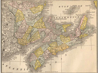
| Details: | New Brunswick & more Canada 1884; 10.5 x 14; Published: 1884 Republished: 2011; Item # FS008 This is a full color reproduction of an 1884 map of the Province of New Brunswick, Nova Scotia & Prince Edward Island, Canada including the northeastern part of Maine and Aroostook County, showing main roads and border crossings. All of these maps come in a protective, archival safe sleeve. |
|